
A Digital Expedition of Himalayan Maize
August 3, 2026
In a post on the Agricultural Biodiversity Weblog, Luigi Guarino, former Chief Scientist at the Crop Trust and one of the most experienced users of Genesys tools, used Genesys to investigate high-altitude maize from two very different mountain regions. He identified 2,388 maize landrace accessions collected above 2,000 metres in the Andes and 96 from the Himalayas, then compared the climatic conditions associated with their collecting sites using AI and the WorldClim dataset.
The initial results suggested clear differences. The Andean locations had a mean annual temperature of around 12°C, compared with approximately 6°C in the Himalayas, while average annual precipitation was estimated at about 750 mm and 640 mm, respectively. The exercise also highlighted some of the challenges of working with accession-level geospatial data, including repeated collecting localities and the limitations of coarse climate datasets in mountainous terrain.
One result, however, stood out. When Luigi explored the Himalayan accessions using the Genesys Subsetting Tool, the precipitation histogram showed a striking cluster of collecting sites at the extremely dry end of the range.
In this follow-up, he investigates that unexpected pattern more closely. The analysis reveals two climatically distinct groups of high-altitude Himalayan maize, including a particularly dry and cold group concentrated mainly in Pakistan and Afghanistan. Many of these accessions were collected during a 1976 Netherlands–Pakistan expedition and are now conserved at CGN in the Netherlands.
The findings raise intriguing questions about irrigation, the interpretation of climate data and the potentially distinctive adaptations preserved in this relatively small group of maize accessions.
In Luigi’s words:
I decided to dig a little deeper into the climatic adaptation of Himalayan maize. You may remember from my last post on this that Genesys has 96 maize accessions from over 2000 masl in the Himalayas, collected at some 50-odd unique localities. When I ran these accessions through the Subsetting Tool in Genesys, I got the following histogram.
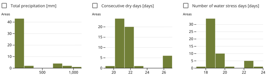
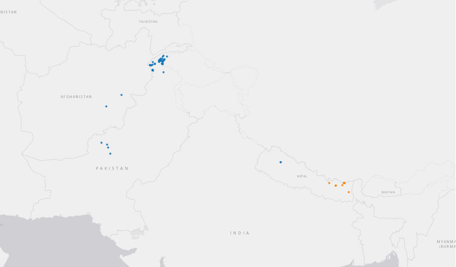
What struck me — and surprised me — was the spike of sites way at the left hand of the precipitation plot. So I took a closer look at the results of the subsetting analysis. And the clustering algorithm it uses to look for similar sites did in fact identify two climatically quite different groups of locations: 45 of the unique high altitude maize collecting sites (the blue ones) are indeed drier than the other 7 (in orange).
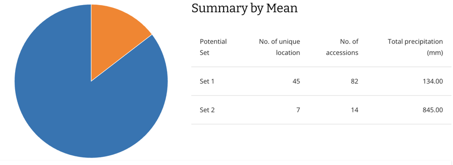
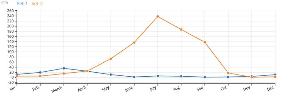
Much drier. (And also colder actually, but that’s another story.)
They’re the ones mainly collected in Pakistan and Afghanistan.
Now, I don’t know whether these areas really get 135 mm of annual precipitation, which seems really low, and in any case the agriculture there is clearly irrigated.
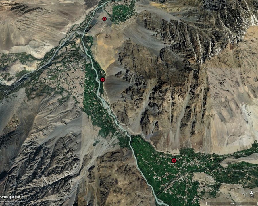
But those maize samples, mainly now conserved at CGN in the Netherlands incidentally, the results of something called the 1976 Netherlands-Pakistan Expedition by the Stichting voor Plantenveredeling, do seem to have some very unique adaptations.